Little Orchard Workshop
British Isles of the Roman era
British Isles of the Roman era
Couldn't load pickup availability
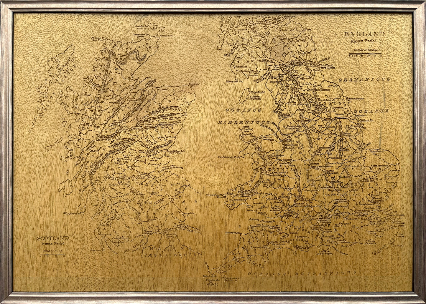
This carved wooden map depicts the British Isles during the Roman period, showing major towns, cities, and the principal Roman road network. The carving is from a map created in the 18th century as no contemporary maps from that period survived to the modern era.
The result is an original carved artwork, informed by historical maps rather than a direct reproduction.
It is A2 in size.
The map is carved into high-quality beech plywood, selected for its stability and clean cutting characteristics. Once carved, the surface is sealed and varnished to enhance contrast and durability, before being mounted and framed in a solid wooden frame, ready for display.
-
Carved wooden map of the British Isles in the Roman period
-
Shows major towns, cities, and Roman road network
-
Derived from curated historical cartographic sources
-
CNC-carved into premium beech plywood
-
Sealed, varnished, and framed ready for display
-
A2 size wall artwork (landscape orientation)
-
Designed and made in the UK
Share